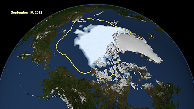
Satellite image shows the record low Arctic sea ice (September 2012). The yellow line shows the average minimum extent over the past 30 years (thank you, NASA)..